
About INTERVAL

The Challenge
The distribution of street trees in most cities worldwide is notably uneven, as evidenced by the body of scientific research. Uneven street tree distribution can lead to social and economic disparities among the communities.
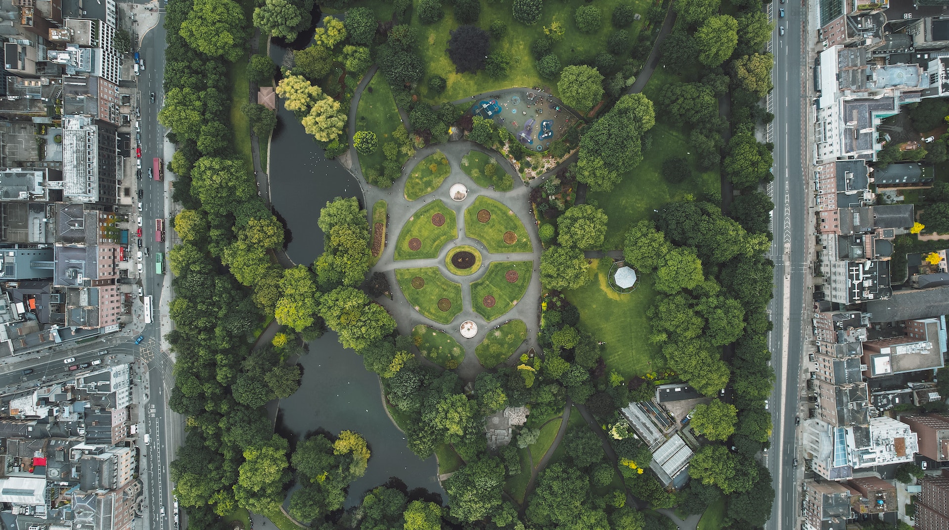
In Dublin city, excluding the high number of trees present in the Phoenix Park, a majority of the street trees are situated on private properties, particularly in the low-density suburban areas located in the northern and southern regions of the city. In contrast, the density of street trees in the city centre is relatively low, with the exception of public parks.
Since street trees play a crucial role in the ecosystem by absorbing carbon dioxide, improving air and water quality, reducing the heat island effect, providing shade, increasing property values and providing habitat for wildlife, the uneven distribution of street trees can lead to a lack of these benefits in certain areas, leading to a less healthy environment.
The Solution
INTERVAL is an INTEgrated stReet tree VALuation based solution for minimizing the uneven street tree distribution in Cities. INTERVAL aims to develop an ecosystem service-based integrated decision support system to increase the street tree density in Dublin city and to promote climate neutrality and minimise environmental injustice that originates due to the inequality of street tree distribution across the geographical spaces in Dublin city.
The specific objectives of INTERVAL are:
- To conduct pilot case studies in both affluent and disadvantaged areas of Dublin to validate the challenge through data-driven quantitative methods, providing a representative sample of the city;
- To measure the prevalence and density of street trees in different city areas using innovative (un)supervised machine learning and deep learning analysis;
- To update existing street tree inventory records with spatial metadata, including information on native and non-native species, for the highest level of the spatial unit;
- To engage local communities and citizens in co-creating knowledge and incorporating transdisciplinary approaches to gauge their willingness to accept and willingness to pay for improving ecosystem services;
- To create a prioritised list of areas that would benefit most from increased tree canopy coverage in Dublin city;
- To develop a comprehensive database of the ecosystem services provided by the most common street tree species in Dublin in order to educate planners, decision-makers, city council administrators, and concerned stakeholders on the vital role street trees play in the city;
- To collaboratively design and implement an integrated web-based platform that serves as a decision support interface for maintaining a spatial database of street tree ecosystem services values.
Project Coordinator
Dr. Srikanta Sannigrahisrikanta.sannigrahi@ucd.ie
Address
Spatial Dynamics Lab,UCD Richview Campus,
D04 V1W8, Belfield, Dublin